Context and scientific stakes of the project
For 30 years, the Pyrenees have provided an innovative framework for research into the dynamics of pastoral systems in high-altitude areas over time. Beginning on the Enveitg mountain in the mid-1980s (Rendu, 2003, Bal, Rendu, Ruas, & Campmajo, 2010, Rendu, et al, 2009) were then set up in about ten interdisciplinary workshop areas, each of them designed as a laboratory for the interactions between societies, their space and their environment over the long term (Fig. 1).
Over the years, this research theme has developed and research has been extended to the Alps (French, Italian, Swiss, Austrian), the Massif Central, the Jura, the Cantabrian Cordillera and the Sierra Nevada in Spain ...to all the mountain ranges
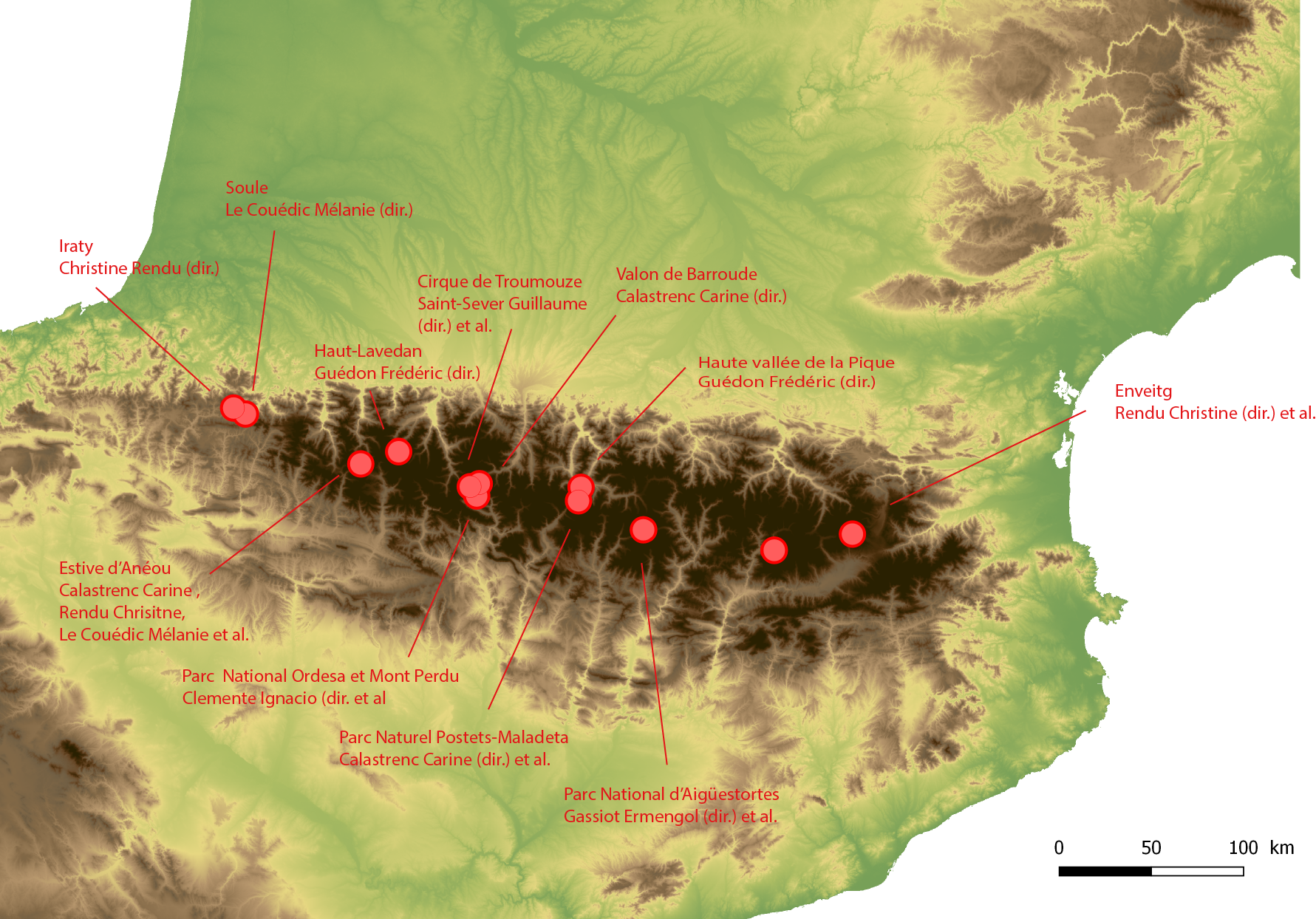
Figure 1 - Location of the different research programmes in pastoral archaeology in the Pyrenees.
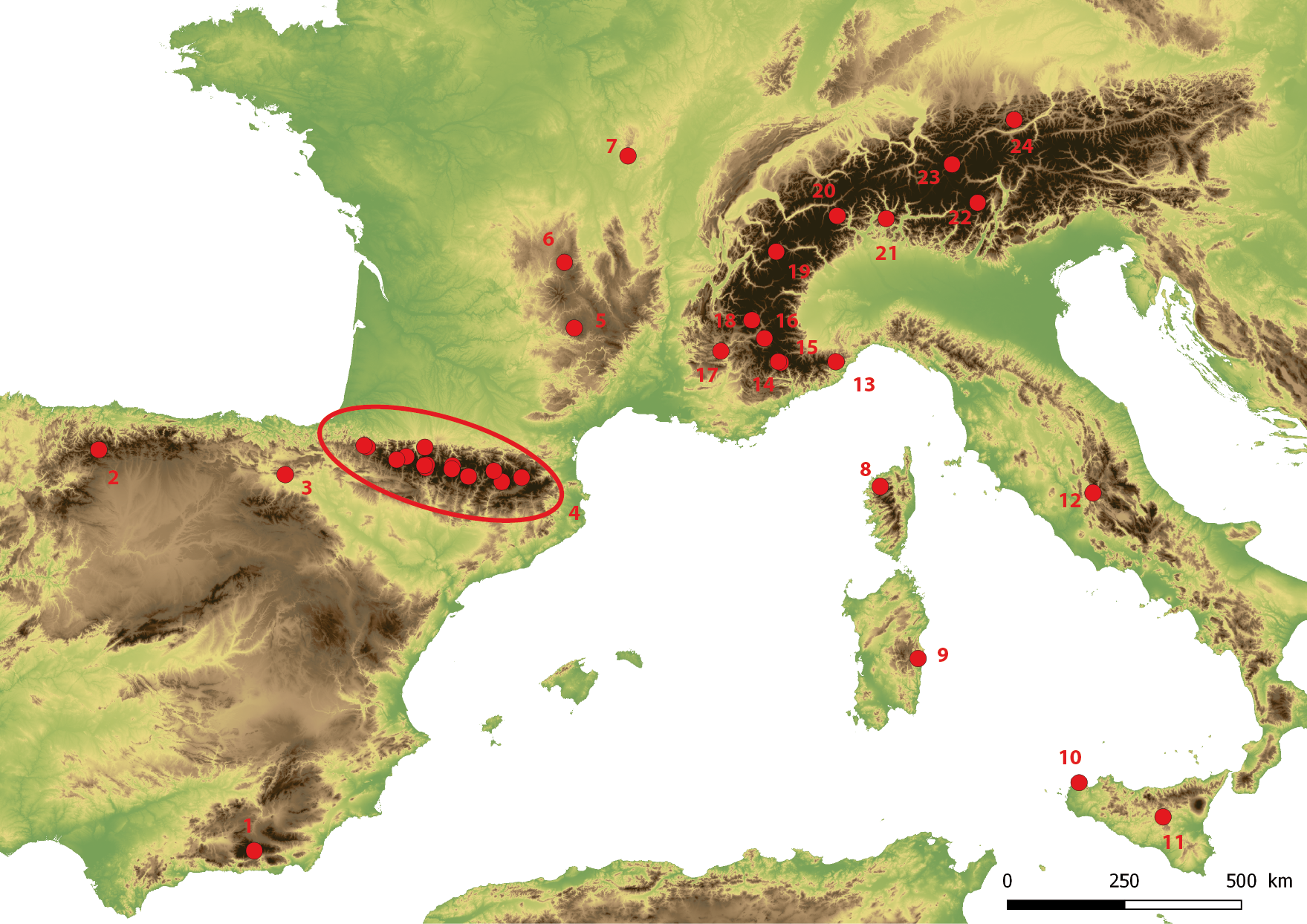
Figure 2 - Location of archaeological research programmes pastoral work in the mountains of southern Europe.
| N° | Zone d'étude | Pays | Responsable scientifique | N° | Zone d'étude | Pays | Resp. op. |
|---|---|---|---|---|---|---|---|
| 1 | Sierra Nevada | Espagne | Romeo. P et al | 13 | Apennin | Italie | Moreno. D et al |
| 2 | Cabrillanes | Espagne | Alvarez D et al | 14 | Mercantour | France | Geist et al. |
| 3 | Alava | Espagne | Varon R et al | 15 | Vallée La Roya | France | Palmero B et al. |
| 4 | Pyrénées (cf fig. 1) | 16 | Ubaye | France | Garcia et al | ||
| 5 | Aubrac | France | Fau L et al | 17 | Vallée de Buech | France | Morin et al |
| 6 | Puy-de-Dôme | France | Toumazet. J-P et al. | 18 | Champsaur | France | Leveau et al |
| 7 | Mont Beuvray | France | Jouffroy- Bapicot et al |
19 | Col du Petit St Bernard |
France | Leveau, Segard e t al |
| 8 | Balagne | France | Weiss et al | 20 | Col du Simplon | Suisse | Cury. P et al |
| 9 | Fonni | Italie | Mientjes et al | 21 | Levantine | Suisse | Della Casa et al |
| 10 | Cistonaci | Italie | Day. P et al | 22 | Val di Sole | Italie | Carrer et al. |
| 11 | Enna | Italie | Mientjes et al. | 23 | Silvretta | Autriche | Reitmaier et al |
| 12 | Cicolano | Italie | Barker et al | 24 | Karwendel | Autriche | Nicolai (von) et al |
At present, given the number of study areas open, it is possible to have a statistically significant and statistically significant quantity of of archaeological prospecting data, but also of archaeological data from the dated data that allow for the systematisation of information and to have a real comparative reading of the evolution of the trajectories of the high altitude territories over the long term.
The different research teams involved in this work are However, they are faced with the problem of acquiring primary information during the prospection phase.
An essential prerequisite for any archaeological research is prospecting (Fig. 3) has specific features: route walking on steep slopes, difficult to access territory, land snowy for part of the year, the obligation to carry all equipment on a man's back or the need to organise and finance a portage (mule or helicopter transport).
Access to the most complete archaeological information possible in the shortest possible time is the challenge of the canvassing.
The following questions then arise:
-
How can prospecting be made more effective in these areas? Which tools to use?
-
How to improve the quality of the information collected during the acquisition, but also during the data processing?
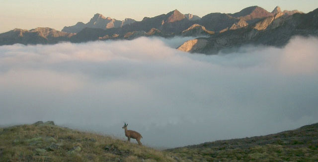
Figure 3 - Estive d'Anéou (Photo C. Calastrenc).
Scientific issues
In contrast to prospecting work on the plains, in high and medium mountain, the detection of archaeological structures is not supported by the on the analysis of the distribution of the artefacts collected on the surface (Poirier, 2010; Poirier & Hautefeuille, 2014, 2015, 2016, 2017). The the plant cover is far too dense and prevents any prevents archaeological artefacts from rising to the surface.
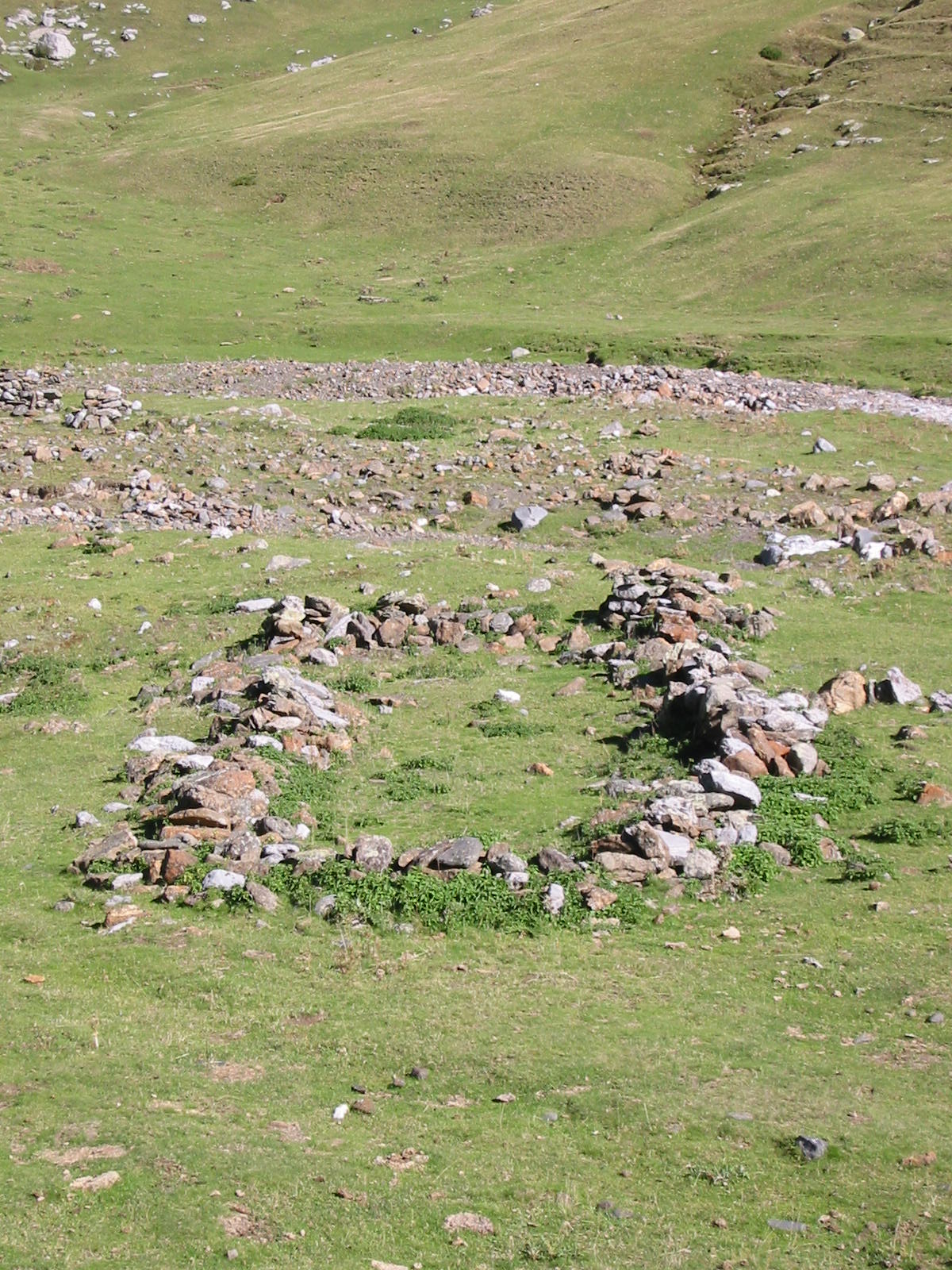
In a very general, but not systematic, way, the infrastructures the most flattened pastoral areas are perceptible through alignments of stones or topographical anomalies (micro-reliefs) (Fig. 4 and Fig. 5) ; the others, more recent, are identifiable by low walls (Fig. 6 and Fig. 7).
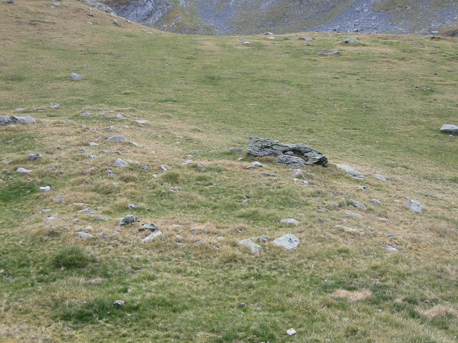
Figure 4 - Structure 11 - Prospecting for Anéou - 2004 *Figure 4 - Structure 11 - Prospecting for Anéou - 2004
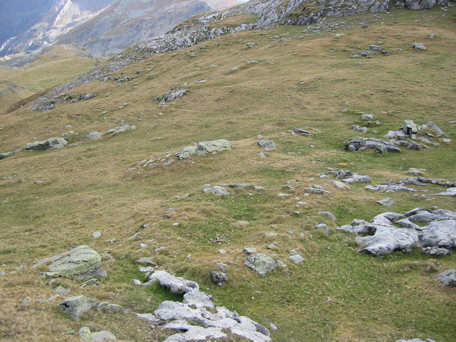
Figure 5 - Structure 14 - Prospecting for Anéou - 2004 *Figure 5 - Structure 14 - Prospecting for Anéou - 2004
 )
)
Figure 6 - Enclos 179 - Archaeological survey of Anéou - 2005.
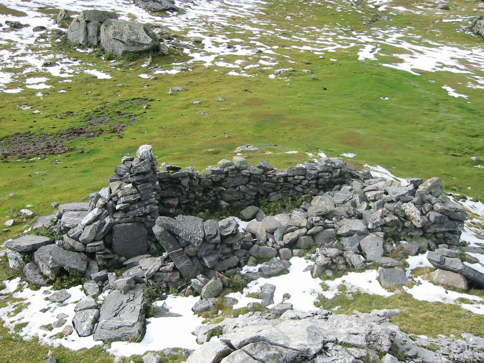
Figure 7 - Cabane 116 - Prospecting in Anéou - 2004 *Figure 7 - Cabane 116 - Prospecting in Anéou - 2004
The semi of points and the plans resulting from this diagnostic work do not be reduced to a simple inventory. Prospecting is a a real tool for historical and archaeological research (Rendering, Calastrenc, Le Couédic, & Berdoy, 2016, p. 61). But in order to do so, he exhaustiveness, because only a representative and complete corpus of data can be statistically strong can allow for an analysis of the spatial organisation of pastoral structures.
In spite of the various technical evolutions that have taken place over the last few years years to facilitate and maximise the work of pedestrian prospecting in high and medium mountains, this phase of the work still comes up against the Today there are two major methodological obstacles:
-
How can we go beyond the framework of a monograph on a summer pasture or a mountain, in order to approach larger areas and thus be able to begin to make real comparisons between territories of altitude on the scale of a massif or a chain by relying on a statistically significant and solid frame of reference?
-
How to complete the corpus of structures visible on the surface with those above ground covered by vegetation, some colluvium, levelled by human activity or because of that they were built of perishable materials?
The research programme TAHMM (Remote Archaeological Remote Sensing in High and Medium Mountains) aims at developing a new procedure for approaching the prospecting of these environments by using of non-invasive methods and the implementation of an integrated approach multi-source, multi-scale and multi-temporal.
New technological advances (diversification and miniaturisation of sensors), the democratisation of certain tools (development of aerial UAVs) and software for the processing of data now make it possible to reflect on the implementation of the new procedures for the acquisition of information for detection archaeological remains.
The research project TAHMM seeks to establish a procedure allowing the detection of the archaeological remains of the activity pastoral and/or agro-pastoral activities in high and medium mountain areas by non-invasive methods. It is not a substitute for the of these spaces, but to implement traditional methods of these spaces and tools capable of handling larger areas with the and resolution to incorporate these features into the design of the new data in a monographic research process (study of a summer pasture, a site, a mountain) or more globally (comparison of territories).
This research project is therefore based on a multi-source and multi-scale approach. From the processing of satellite images to physico-chemical analysis and the acquisition and study of data acquired by drone with different sensors, all the archaeological remote sensing and geophysical tools will be used to identify archaeological remains in high and medium mountains.